About Me
I'm a fledgling geospatial professional looking for opportunities to apply my skills and continue building knowledge.
I strive to stay software-agnostic: I'm comfortable working with a wide range of tools and data.
Most importantly, I'm confident in my ability to learn and adapt.
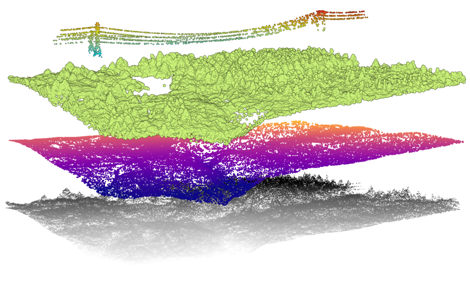
LiDAR point cloud classification, DTM creation, and feature extraction
(Processed using ArcGIS Pro)
My Portfolio
You can view a portfolio of past work, ongoing projects, and favourite resources here. (It's a work in progress!)
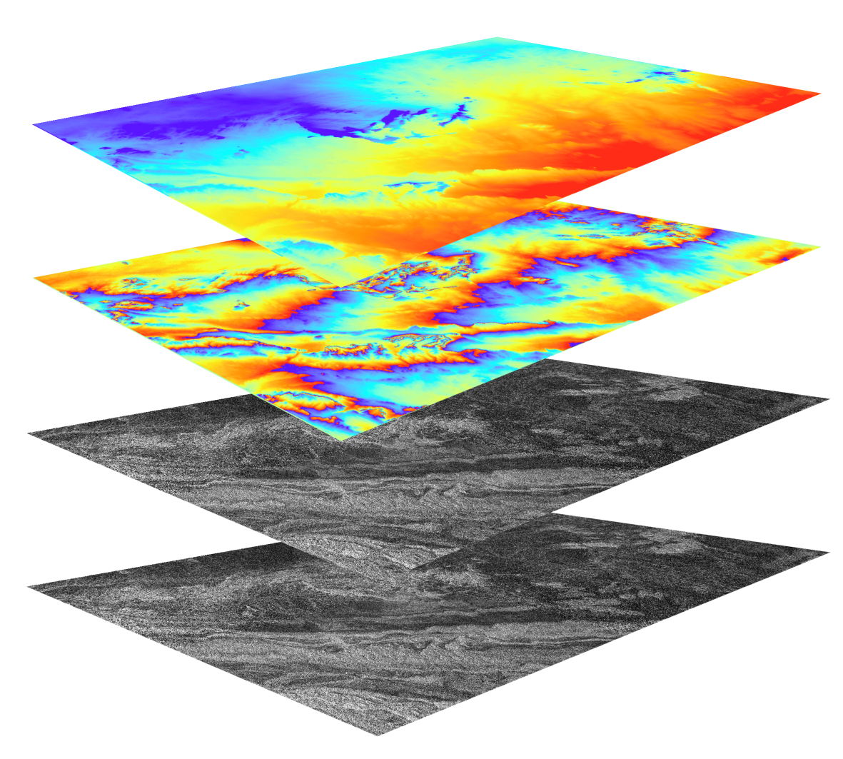
Interferometric DEM workflow
(Processed using SNAP & SnapHU)
I'm particularly interested in collecting, analyzing, and visualizing diverse sources of data in order to derive meaning and solve real-world problems.
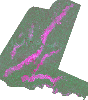
My personal projects and research often explore the intersection between remote sensing, illegal resource extraction, conflict, and organized crime. This has, in turn, spurred an interest in building functional knowledge of synthetic aperture radar imagery as well as handling large datasets. The animation below, for example, was created using a series of nearly 300 Sentinel-1 images spanning 2016-2020; it shows the expansion of illegal gold mines in Madre de Dios, Peru.
Sentinel-1 Time Series of Illegal Gold Mines in Peru, 2016-2020
(Processed using Google Earth Engine and ArcGIS Pro)
At this point, I consider myself a "confident beginner" when it comes to working in Python or R - I am familiar with many of the relevant libraries and can comfortably adapt notebooks or code to suit my purposes, but I'm not writing custom scripts (yet!). This is one of the topics I'm most excited to cover at BCIT.
I'm more confident when it comes to web cartography. Javascript was my first language; it gave me the tools to share my work with a broader audience and add interactive elements.
Some proficiencies and areas of general knowledge include:
| Desktop |
ArcGIS Pro, QGIS, ESA SNAP, GRASS, ArcMap, L3Harris ENVI, Catalyst Professional |
| Javascript |
Leaflet, Turf, Cesium, Mapbox GL JS, D3, jQuery |
| Python |
ArcPy, Pandas/GeoPandas, Geemap, Sarsen, SentinelSat, Whitebox Tools |
| Other Tools |
RStudio, Google Earth Engine, ArcGIS Online, VS Code / Notepad ++, PostgreSQL, AutoCAD, Excel, Adobe Photoshop & Illustrator, OpenDroneMap, ASF Vertex |
| Data |
LiDAR, Orthophotography, Multispectral Imagery, Synthetic Aperture Radar, In Situ Measurements |
| Processes |
Imagery Processing & Correction, Segmentation & Classification, DEM/DTM Generation, Spectral & Terrain Analysis, TIme Series & Change Detection, Land Cover Mapping, Stream Network Modelling, Slope & Flood Hazard Analysis, Accuracy Assessment, Automated Processes, 2D/3D/Web Cartography |
Education
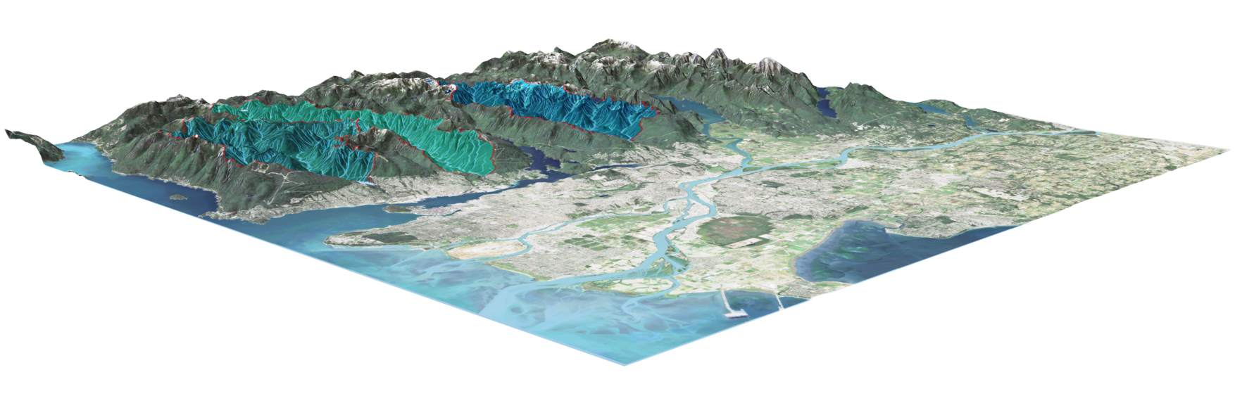
Interactive 3D model of Vacouver's Watersheds
(Processed using Google Earth Engine, QGIS, and Mapbox GL JS)
British Columbia Institute of Technology
Advanced Diploma in Geographic Information Systems
2024
University of British Columbia
BA Geography (Environment & Sustainability)
2023
Langara College
AA Geography + Certificate in Latin American Studies
2018
GEOS Languages Victoria
Teaching English as a Second Language Certificate
2010
Contact
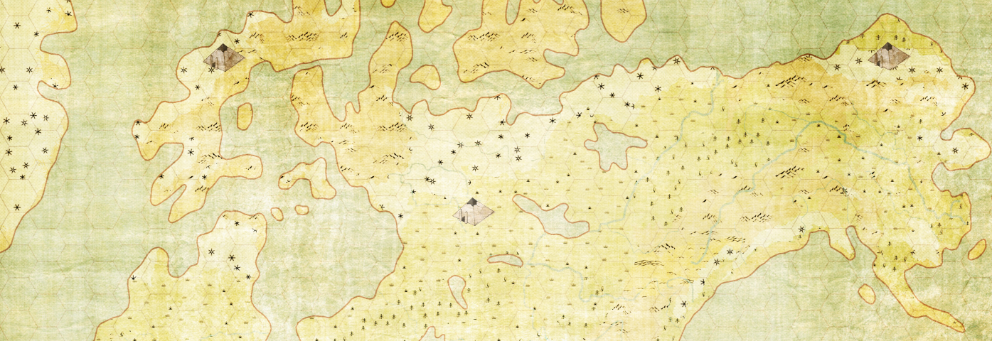
Fantasy Cartography
(Processed using Inkscape, ArcGIS Pro, and Mapbox GL JS)
Feel free to contact me directly at cw.geospatial@gmail.com or via LinkedIn